Sunday, July 8, 2012

City Creek Bike Ride Part 1, June 29, 2012

  From the Salt Lake Cycle website: "This great ride enjoys the solitude of being without cars - but is only available on odd numbered days. The ride averages a 7.3% grade, but really seems like two very different rides to me. The lower portion is a lot like Millcreek and averages a 5.6% grade of mostly rolling hills. Once you pass the water treatment facility (I think that's what it is) the road deteriorates and gets quite narrow. This upper section averages a 9.4% grade with some rather steep sections and is mostly shaded with lots of water running past."
Jim convinced me that I should try to ride up City Creek Canyon, so I decided to try.
 

Walter Mills went with us this Saturday morning.  We started at 7:30 am to go when it was cool, since it had been in the 90's all week.

Cool bridge.

This is a meadow view as we rode up.
 

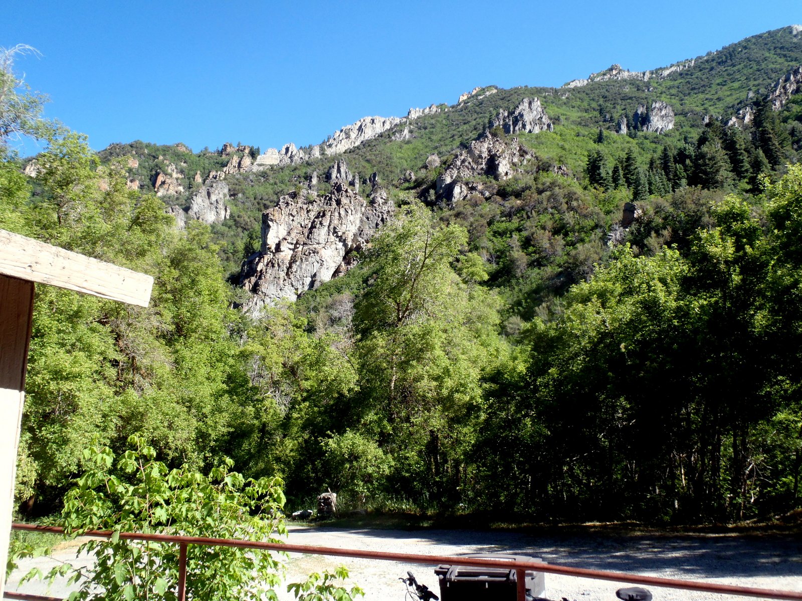
This is looking backward from where we had just ridden.

One of the nice outhouses along the trail.
 

Beauftul weeds which were growing near the road in the meadow area. 
 

This is about halfway up at the water treatment plant.  The ride this far was "do-able" From here up it gets real steep, and the road gets more narrow.
 

A view from the water treatment plant.

This is the "south bound' end of a "north bound" bug on the weed.
 

These are the rules on biking the canyon.

We get to see more of the City Creek on this stretch of the road.
Posted by Picasa

City Creek Canyon Ride Part 2, June 29, 2012


This marker is just a mile or so north of the water treatment plant. I do not know what it is for.  This section of the trail is much steeper with some grades as much as 9 %.  I walked the steep parts and rode the less steep parts.

This waterfall is near one of the Rotary Parks.  It is very beautiful.

This is a close-up of the previous waterfall 

This is another close-up.

 This is one of the Rotary picnic areas.

We walked down a path in the Rotary park and found this covered pavilion.  It was on a pennisula with the creeks on both sides.  It is noisy from the cascading water, but very pretty.

Here is a close-up of the pavilion.

This is one of the waterfalls on the side.

This is another waterfall.

Walter and Jim are on the trail.

Jim is holding my bike for me.

 Another shot on the trail.

This is a grotto where the water just comes out from the rock.

These rocks around the grotto were fascinating.

One of the views going up the mountain shows many rock out croppings.

This is the end lof the bike ride for City Creek Canyon.  I made it!  Phew!  It was the hardest thing I ever did!  We are at about 6200 feet.

We gained 1500 feet in 6 miles.  This is Jim, me and Walter.  We had to prove that I made it.  Going down was hard also, for me.

These butterflies were at the top of the mountain.  Pretty.

This is a view from the top of the mountain.  They had a water faucet and a bench to relax there.  There are outhouses all the way up the mountain, as well as several water fountains.  There are also many picnic tables an the way up.

These were pretty little blue flowers.


Posted by Picasa

Immigration Canyon Ride, June 16, 2012


Jim and Walter Mills decided to ride up Immigration Canyon, the canyon where the Saints came through with their wagons to the Salt Lake Valley.  Jim started at the KOA and rode to Walter Mills' apartment by Temple Square.  Then they both rode across the valley to the canyon and up the canyon.  The KOA is about 4,200 feet and Jim ended at about 6,800 feet in about 16 or 17 miles.  Then back home the same way.

There are all kinds of cyclists on that road up the canyon every day except when it is snowing!  Very popular ride.
                                                          This shows how steep some of the grades are.
 It looks like too much work to me!

Jim is coming up one of the steep grades.  Most of the grade up is 5 % but there are some 8 & 9 % grades also.

Here is Walter Mills about 2 miles from the top.  Walter, sadly, got dizzy & light headed and had to stop within a mile of the top. The altitude was a factor.
 
                                                          Jim and walter posing at the same place.  A cyclist must have come along and shot this photo!  The cyclists are, for the most part, very caring and helpful people.

This is another steep grade with several cyclists making their way.  Great scenery!


Jim made it to the summit and had this photo shot by another cyclists.  He left Walter back 1 miles, sitting on the ground in the shade resting.

This stone structure is a marker for the summit of what they call "little mountain", at the top  of Immigration Canyon.  Elevaton a little over 6,200 feet.

Off to the left is a reservoir to which you can ride your bike.  It looks small here but we drove by it once when there was a kayaker on it and even from the road he was only visable because of his movement.  He was so small!  These mountains will fool your eyes!
 This sign tells about the settlers who came through this canyon.  I do not know how they held those wagons back as they descended.
                                                         This is another shot of the road going down to the  Reservoir.

 Coming back down, Walt and Jim stopped at this memorial for the Mormon Battalion.  Brigham Young is depicted on the left.  By now, Walter is feeling much better.

They both ignored the sign which said no bicylces or skateboards.  However they did  only walk their bikes over and did not ride in the memorial.  On the way back home they had lunch, with coupons, at Carl's Jr, a hamburger place at State & 2nd; then rode back home.
Posted by Picasa