The Marina is a State Park. Here is one of the signs which tell a little about the Great Salt Lake and it's history.

This close-up of the salt content of the Great Salt Lake was interesting.

This I think is an islander outrigger canoe. There used to be a lot of polynesian people in this area. I guess there are still a few left. Note the block to rest it off the sand. There is a rowing & kayak club which meets at the marina. This canoe was behind their building.

This view is from one side of the marina toward Antelope Island. The water is very blue!

We should have put our arms up like on the Titanic, right? This is another view of the Island from the marina.

How to you like this close-up of two old landlubbers? Do you like our "hat hair"?

Here is Jim with our friend & buddy cyclist, Walter Mills. Elder Mills is on a Church Service Mission here and works along side us in the Training Zone. We knew him from our 2005-2006 mission and the Family History Library where we also worked together.

Here they are with a sailboat between them in the distance. What a beautiful day! The Marina, by the way, was about 19 miles from our KOA campsite.

This sailboat is leaving the marina to go out into the lake.

In leaving the marina, there was this little pond with all the grasses and the distant mountains, which I found to be very pretty.

The Saltair resort is about 1 1/2 miles short of the marina so we decided to visit it on the way back toward home. This distant shot of the Saltair shows Walter Mills and Jim cycling down to the building. (Read on for more infomation on the Saltair.) Years ago they would be in the Great Salt Lake, but the lake has receded.

Here is a close-up of the exterior of the saltair. The day was beautiful and sunny.

This interior shot of the Saltair, shows a large dance floor and the balcony where the band usually played. It is a venue for some performers now but nothing like in it's hayday of the big band era.

This is a model in the gift shop of the Saltair. It was amazing in detail, showing how it looked at the turn of the century. We bought yummy salt water taffy in this gift shop.

On the way home, we were given the treat of seeing this hawk alight a telephone pole. I think he was a marsh hawk. I did not have the telephoto on when I took the hurried shot, since my fellow riders were way ahead of me. They should know that I stop for bird photos!

This view of Saltair shows what it looked liked originally with the RR tracks on the side. It was built in 1893 and was the western counterpart to Coney Island on the east coast. It originally had an indoor bicycle track, roller coaster and the largest dance hall in the United States.

People came out on the Los Angeles and Salt Lake Railway Company trains to visit Saltair. Trains left every 45 minutes from Salt Lake City.

These are really "bathing suits" especially for the women in the late 1800's & early 1900's. Note the stockings and shoes on the women, as well as the dresses and even hats! Men had it much better! I remember my mother talking about these bathing suits of the early 1900's.

This is the second fire, in 1931, which destroyed most of the building. The first fire was in 1925, and was extensive also.

Saltair as viewed from the lake, about 1900. In it's hayday! Photo was from Wikipedia.
 Saturday, May 12, 2012, we went with our friend, Walter Mills, to attempt to ride out to the Great Salt Lake Marina. On the way, we stopped at a golf club for a drink from this fountain.
 We have to go through this tunnel to continue on our way past the airport toward the marina. I think it goes under one of the roads to the airport.
 Once we arrived on a frontage road for I-80 west, we went by a small pond which had these American Avocets in it. Aren't they beautiful!
 This is a view alongside this 10 or 11 mile stretch on the frontage road, toward the marina. The red shirt belongs to Walt Mills.
 Time for a short break for photos of Jim and Walt. Walt is a new bike rider and has taken to it like a duck to water! Of course neither Jim nor I have been biking long either!
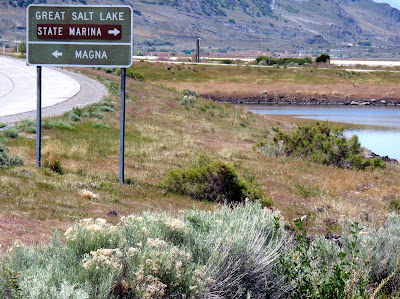
 This is to prove that we are actually near the Great Salt Lake Marina. Note the sagebrush in the foreground.
 Here is Walt on his new bike! He has named it D.O.T. or DOT for short. (Had to be a female name) Cute, eh? We had a contest at the Training Zone to name his bike and Sherry Carlisle submitted that name. I submitted "Cheekie" :-) as a name, which won by popular vote, but he chose the DOT, which is really a better choice.
 This is Jim with the Saltair & the Great Salt Lake in the background. You have to read more for information on the Saltair.


