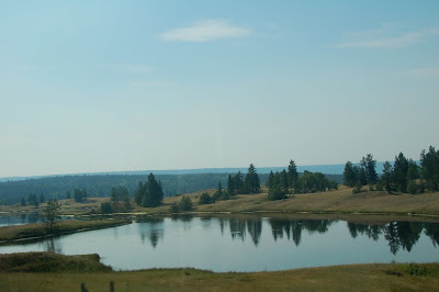
Thursday, August 27, we left Meziadin Provincial Campground & headed back south on Rt 37, the Carssiar Highway to join Rt 16, the Yellowhead highway to Prince George, BC.

Our neighbor's boy, about age 8-9, went into the lake on this cold 56 degree morning before 11 am. He made me cold just looking at him! He was a brave little guy. It was summer and he was going to enjoy it.
.JPG)
This is Seven Sisters Mountain in the background.

This is anoher view of those seven peaks. The highest one is 9,140 ft.

Once we were back on the Yellowhead Highway heading east, the first major town we came to was New Hazelton. The Visitor's Center there had a free RV Dump Site which we used. These statues at the Visitor's Center, represented the three major economic influences in the town. This one is the Lumberjack. Logging & Timber Manufacture is their biggest employer here.

This is the miner. The Skeena & Bulkley Rivers join here and the town provided a place for the wintering of miners. Many goldrushers traveled through here in the 1870-1880's.

This statue represents a fur trapper. The Hudson's Bay Company established a post here in 1868.
.JPG)
This is a distant shot of Hudson Bay Mountain, north of Smithers, BC.
.JPG)
This is a closeup of the same mountain with it's glacier.

This statue of a pack horse was unnamed. Someone must have erected it to honor all those horses who helped the miners & trappers with their goods.

We had seen all kinds of road construction signs but this was a new one for us. He came at us in the middle of the road, as you can see and wanted us to stop, which we did.

There were lots of old barns in this area of Canada and I wanted to capture a few. This one is pretty neat!

This is a hotel in Burns Lake, about halfway to Prince George, B.C..

This is a Cairn, called the Tintagel Cairn. (Look it up in Google!) It has a stone, the large, square-ish green one, in the middle bottom, which was once part of the Norman walls of Tintagel Castle, where King Arthur supposedly was born. Interesting...why here???

This is Fraser Lake Sawmill. This is only a little bit of the wood they had piled up. They really had lots of lumber!

We made it to Prince George & another Walmart for the night! :-)


 This is a scene on Rt 97 south of Kamloops. I thought it was near Monte but I may be wrong.
 This is another old barn and attached buildings. I love the old wood on these buildings!
 This is an old church. I am sorry about the insect blobs on some of these photos but they were very thick and unavoidable! Naturally I had to take these photos through the window as we whizzed by. Or maybe it was raindrops??? I think it was insects.
 This is a side window shot and therefore the reflection! :-) This is another grand old house... or barn?
 This is a Falkland Town Street Scene.
 Lake View Coming south into Vernon.
.JPG) More views of the lake.
More views of the lake. Kelowna Sign
 Biking & Floating on the river near Kelwona.
 Lake & Cliffs near Oknagan Falls.
.JPG) Vineyards south of Okanagan Falls.
Vineyards south of Okanagan Falls. Chief Joseph's Dam, Washington, USA
.JPG)

.JPG)


.JPG)

.JPG)
.JPG)

 It is nice to see large farms with hay and other crops. It is also nice to see electrical poles. We are in civilization! (Compared to rugged Canada & Alaska!)
.JPG)


.JPG)


 Our neighbor's boy, about age 8-9, went into the lake on this cold 56 degree morning before 11 am. He made me cold just looking at him! He was a brave little guy. It was summer and he was going to enjoy it.
.JPG)


.JPG)
.JPG)


